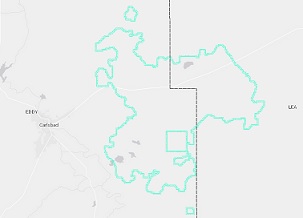
R-111-P Potash District Boundaries
Shapefile

Tags
Potash District, WIP, Waste Isolation Pilot Plant, New Mexico, Oil Conservation Commission
Polygon layer defining the Potash District boundary in southeast New Mexico.
This layer illustrates the boundaries of the Potash District as defined by New Mexico Oil Conservation Commission's Order R-111-P, issued April 21, 1988. Also delineated within the feature class is the boundary of the Waste Isolation Pilot Plant. Construction of this layer was predicated upon the need to know and to illustrate the location of the R-111-P boundaries in order to conduct lease management more efficiently within the New Mexico State Land Office.
Projection: UTM Zone 13N - NAD83 (meters)
Attributes:
Label: NAME
Definition: Name of the potash region.
Land Office Geographic Information Center (LOGIC) NM State Land Office PO Box 1148 Santa Fe, NM 87504 logic@slo.state.nm.us
These data are subject to change without notice. No warranty is made by the New Mexico State Land Office as to the accuracy, reliability or completeness of these data.
Extent
West -104.072030 East -103.487210 North 32.759337 South 32.156641